
Grand Canyon Hiking trails offer some of the most unforgettable hiking experiences on Earth. From scenic rim walks to adventurous canyon treks, the Grand Canyon has it all.
From short scenic walks along the rim to multi-day treks into the canyon’s heart, the Grand Canyon offers some of the most unforgettable hiking experiences on Earth. Whether you’re an adventurous beginner or a seasoned backpacker, this guide reveals the top hiking trails in the Grand Canyon, complete with trail highlights, distances, elevation gain, difficulty levels, and tips for a safe journey.
- Location: Northern Arizona, USA
- Size: 277 miles (446 km) long, up to 18 miles (29 km) wide, and over a mile (1.6 km) deep
- Rim Access:
- South Rim: Open year-round, most popular and accessible
- North Rim: Open mid-May to mid-October, quieter and higher elevation
- Best time to hike: Spring (March–May) or Fall (September–October)
 About the Grand Canyon hiking trails in the National Park
 About the Grand Canyon hiking trails in the National Park
 Types of Trails in the Grand Canyon
- Rim Trails: Mostly flat paths with views from the edge — easy and accessible
- Corridor Trails: Main maintained trails into the canyon — suitable for day hikes or overnights
- Primitive Trails: Remote and rugged — for experienced hikers only
1. Bright Angel Trail (South Rim)
 1. Bright Angel Trail (South Rim)
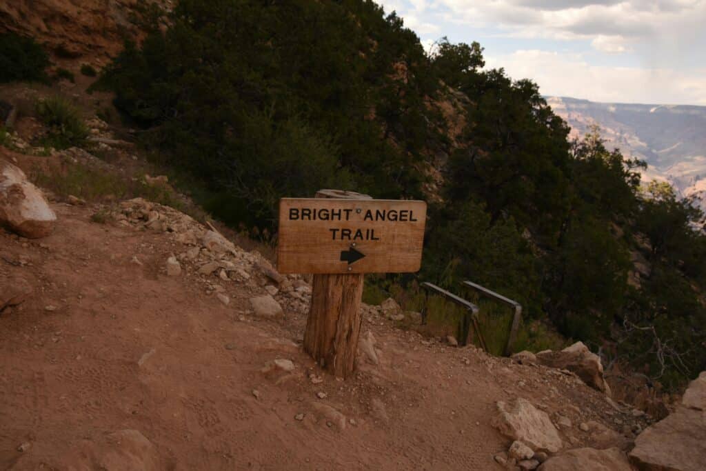
Distance:
 Distance:
- 12 miles (19.3 km) round trip to Plateau Point
- 19 miles (30.5 km) round trip to Colorado River (Bright Angel Campground)
Elevation Change:
 Elevation Change:
- ~4,460 feet (1,360 meters) to the river
Difficulty:
 Difficulty:
Moderate to strenuous (especially on the return uphill)
Water Availability:
 Water Availability:
Yes — seasonal water stations
Overnight Options:
 Overnight Options:
- Indian Garden Campground
- Bright Angel Campground (via permit)
Highlights:
 Highlights:
- Sweeping views of canyon walls, Indian Garden oasis, ancient rock layers
- Plateau Point overlook — a stunning view of the Colorado River
- Frequent shade and resthouses
Why Hike It?
 Why Hike It?
It’s the most iconic trail in the Grand Canyon. Well-maintained, ranger-patrolled, and filled with geologic and cultural history.
Tip:
Don’t attempt to hike to the river and back in one day unless extremely experienced and fit. Opt for Indian Garden or Plateau Point as a day hike instead.
Among the top-rated Grand Canyon Hiking Trails is the Bright Angel trail
2. South Kaibab Trail (South Rim) Hiking trail
 2. South Kaibab Trail (South Rim) Hiking trail
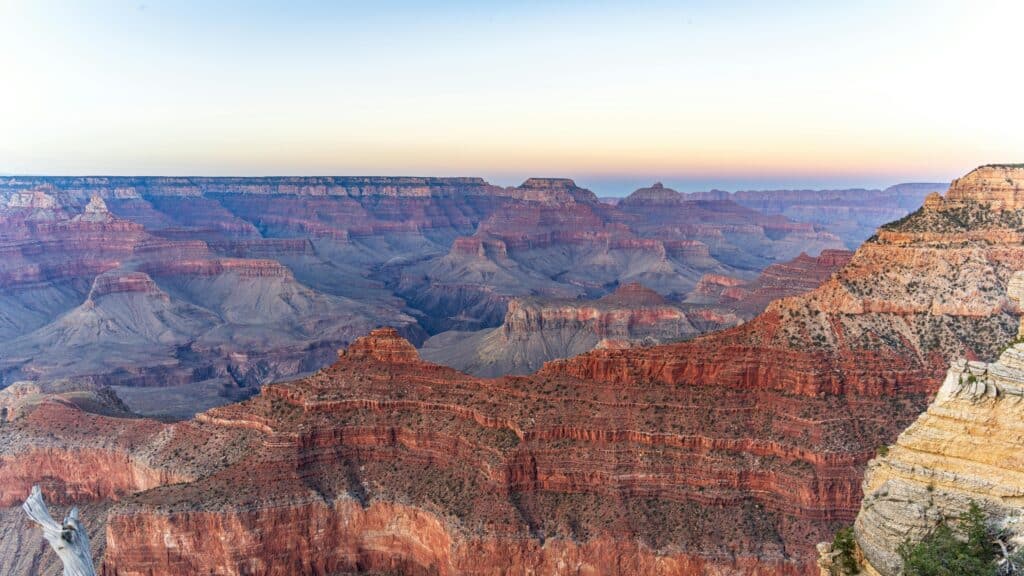
Distance:
- 3 miles (4.8 km) round trip to Cedar Ridge
- 6 miles (9.6 km) round trip to Skeleton Point
- 14.6 miles (23.5 km) round trip to Colorado River (Bright Angel Campground)
Elevation Change:
- ~4,780 feet (1,457 meters) to the river
Difficulty:
Strenuous — no water along the trail!
Water Availability:
None on the trail — only at trailhead
Overnight Option:
Phantom Ranch or Bright Angel Campground (permit needed)
Highlights:
- Panoramic views (trail follows ridgelines)
- Ooh Aah Point — early breathtaking viewpoint
- Steep but direct descent
Why Hike It?
Possibly the most scenic trail per mile in the park. You’ll be rewarded with sweeping, open canyon vistas almost every step.
Tip:
Best for early morning hikes. Do it downhill and return via Bright Angel for a loop if backpacking.
The most scenic Grand Canyon hiking trails are found along the South Rim
3. North Kaibab Trail (North Rim)
 3. North Kaibab Trail (North Rim)
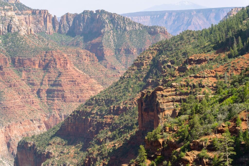
Distance:
- 9.4 miles (15.1 km) one way to Bright Angel Campground
- 14 miles (22.5 km) round trip to Roaring Springs
- 28 miles (45 km) round trip to Colorado River and back
Elevation Change:
- ~5,850 feet (1,783 meters) to the river
Difficulty:
Very strenuous — recommended as a multi-day hike
Overnight Options:
- Cottonwood Campground
- Bright Angel Campground
Highlights:
- Roaring Springs & Ribbon Falls
- Forested alpine start transitioning to red desert canyon
- Cooler temperatures than South Rim
Why Hike It?
This is the least crowded but most dramatic descent into the canyon. It’s part of the legendary Rim-to-Rim route.
Tip:
North Rim is only open ~May–October. Great for cooler summer hikes.
4. Rim Trail (South Rim)
Distance:
13 miles (21 km) one way
Elevation:
Mostly flat — perfect for all levels
Difficulty:
Easy
Water & Shuttles:
Available at major points; park shuttle runs parallel
Highlights:
- Grand Canyon Village to Hermit’s Rest
- Numerous viewpoints: Hopi Point, Powell Point, Mohave Point
- Sunrise and sunset walks
Why Hike It?
Ideal for beginners, families, or those who want epic views without descending into the canyon. Wheelchair/stroller accessible in sections.
Tip:
Take the shuttle west, walk east with the canyon views ahead of you.
5. Havasu Falls Trail (Hualapai Hilltop to Supai Village)
 5. Havasu Falls Trail (Hualapai Hilltop to Supai Village)
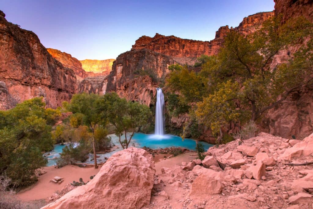
Distance:
10 miles (16 km) one way to Supai
12 miles (19 km) to Havasu Falls
14 miles (22.5 km) to Mooney Falls
Elevation Change:
~2,400 feet (732 meters)
Difficulty:
Moderate to strenuous, long hike + heat
Permits Required:
Yes – must book in advance via Havasupai tribe (often 6+ months ahead)
Highlights:
- Turquoise blue waterfalls in a red canyon
- Swimming in natural pools
- Camping in a paradise-like setting
Why Hike It?
This once-in-a-lifetime bucket list hike is not technically inside Grand Canyon National Park, but it’s part of the same system. The beauty is unreal.
Tip:
Pack light, wear trail runners, and book as early as possible.
Bonus: Rim-to-Rim (North Rim to South Rim or vice versa)
 Bonus: Rim-to-Rim (North Rim to South Rim or vice versa)
 Distance:
21–24 miles (33–38.5 km) one way depending on route
Elevation Change:
~5,700 feet (1,737 meters) gain/loss
Difficulty:
Extremely strenuous — only for well-trained hikers or backpackers
Overnight:
 Overnight:
- Cottonwood or Phantom Ranch + Indian Garden
Why Hike It?
This is the ultimate Grand Canyon challenge. You’ll experience nearly every major climate and geological zone in a single epic journey.
Important Safety Tips for Grand Canyon Hiking
 Important Safety Tips for Grand Canyon Hiking
| Tip | Details |
|---|---|
 Start Early Start Early |
Hike before 10am and after 4pm to avoid extreme heat |
 Hydration Hydration |
Carry at least 3–4 liters of water, electrolyte tabs |
 Sun Protection Sun Protection |
Hat, sunglasses, SPF 50+ |
 Footwear Footwear |
Trail shoes or boots with grip |
 Emergency Plan Emergency Plan |
Know where ranger stations are; carry a whistle |
 Turnaround Rule Turnaround Rule |
Go down only 1/3 of the time/distance you can hike up |
 Essentials Essentials |
Map, snacks, headlamp, phone, first aid kit, water filter |
Recommended Gear for Canyon Hiking
 Recommended Gear for Canyon Hiking
- CamelBak or 3L hydration bladder
- Lightweight backpack (15–30L)
- Electrolyte mix / energy bars
- Layered clothing (it can get cold even in summer)
- Trekking poles (helpful on the descent)
Where to Stay
South Rim (More Lodging & Access)
- Inside the park: El Tovar, Bright Angel Lodge, Yavapai Lodge
- Nearby towns: Tusayan, Williams, Flagstaff
North Rim (Limited)
- Grand Canyon Lodge North Rim (book early!)
- Kaibab Lodge or camping
Best Viewpoints for Non-Hikers
 Best Viewpoints for Non-Hikers
- Mather Point (easy access, iconic view)
- Yavapai Point & Museum
- Desert View Watchtower
- Grandview Point
- Hopi Point (sunset spot)
Map of Trails (for Embedding)
 Add a dynamic Grand Canyon map on your site via Google Maps embed or AllTrails.
Final Thoughts
 Final Thoughts
Hiking in the Grand Canyon is not just an activity — it’s a soul-stirring experience. Whether you’re descending into the belly of the Earth on the Bright Angel Trail, walking the quiet North Rim, or standing beneath turquoise waterfalls at Havasu, you’ll discover why millions of people fall in love with this canyon every year.
 Be respectful. Hike smart. Leave no trace. And above all: take your time to feel the power of this natural wonder beneath your feet.
Book Here amazing excursions on the grand canyon
Want to explore more of the Southwest? Read our guide to the Top Horseback Riding Tours in Bryce Canyon — a perfect way to see even more of nature’s beauty!
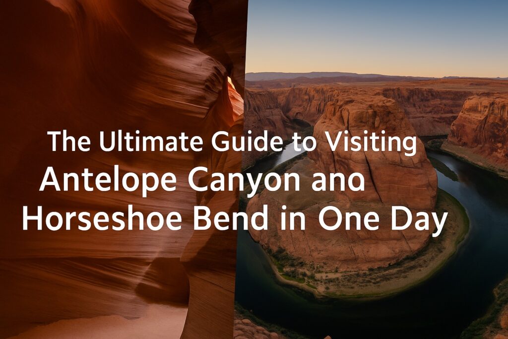
The Ultimate Guide to Visiting Antelope Canyon and Horseshoe Bend in One Day

Ultimate Guide to Visiting Alcatraz: History, Tours & Where to Stay
Ultimate San Francisco Travel Guide
Top 10 Most Romantic Countries in the World for Couples
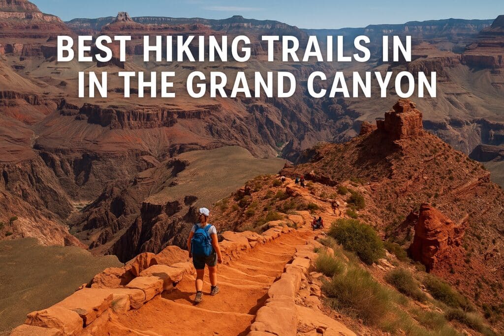
The Ultimate Grand Canyon Hiking Trails


